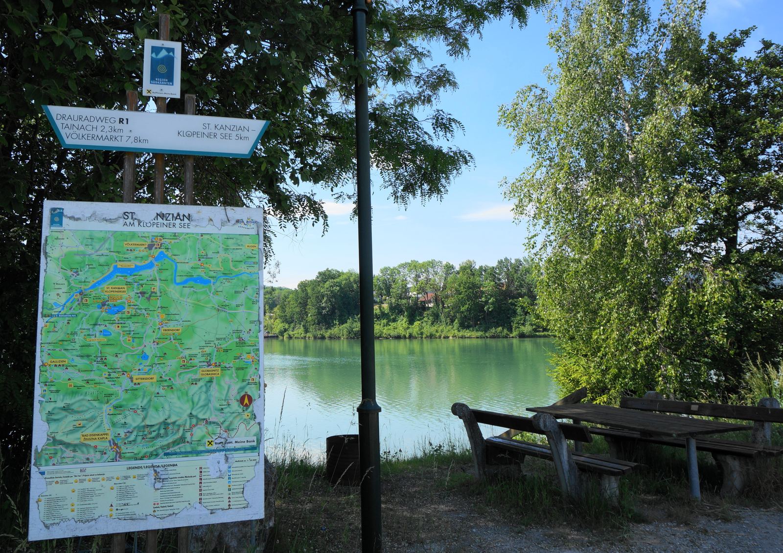
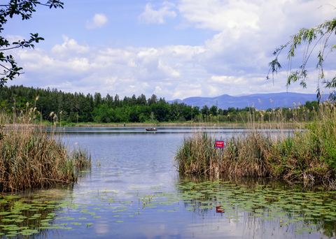
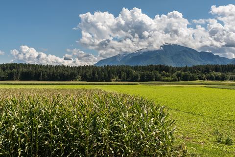
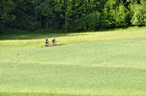
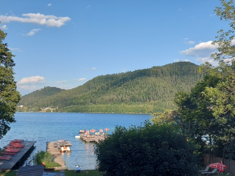
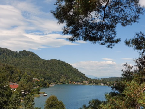
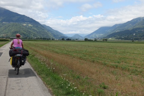
Flat rides around the lakes, the Drava and sporty trails – many tours start right at the front door. Guided tours are free with the Aktiv Card, and bikes to hire are close by.
29 places · 12 bike tourssorted by distance from our house
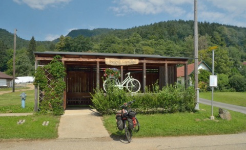
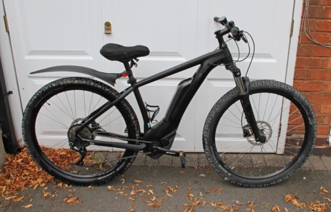
Included with us: safe, free charging for your batteries and a sheltered place for the bikes. Plus tours from the front door and why May, June and September are the best months for cycling.
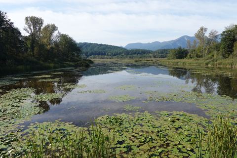
St. Kanzian – Klopeiner See – Kleinsee – St. Primus – Turnersee – Sablatnigmoor – Gösselsdorfer See – Sittersdorf – Sonnegger See – Jaunstein – Globasnitz – Pirkdorfer See – Loibegg – Eberndorf – Unterburg – St. Kanzian
May/June and September – in high summer with swim stops
At a glance
Loop
Back roads and cycle paths, one stretch on the cycle path alongside the main road
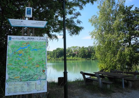
Start/finish: St. Kanzian bike info point – you can also join right by the house (approx. 150 m)
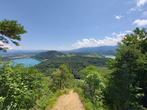
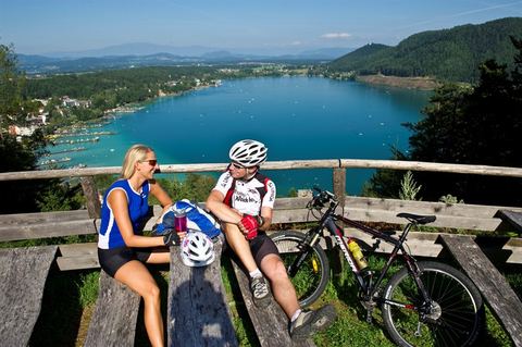
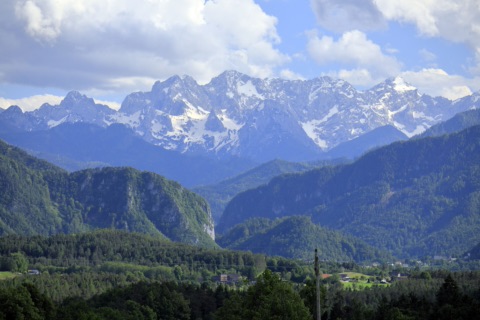
Kitzelberg loop with viewpointfrom the houseFor those who like it a little hillier – partly on gravel tracks: from Seelach you ride up the Kitzelberg, where a viewpoint rewards you with a view over the lakes and of the Karawanks.
For those who like it a little hillier – partly on gravel tracks: from Seelach you ride up the Kitzelberg, where a viewpoint rewards you with a view over the lakes and of the Karawanks. Then you roll via St. Veit im Jauntal and St. Primus – right past our house – to the Sablatnigmoor and back via Grabelsdorf and Unterburg.
The loop is not specially signposted; you will find the route on bergwelten.com, and the details on our e-bike page.
May to October
At a glance
Approx. 21 km · approx. 390 m of ascent · moderate
Partly gravel tracks
Start and finish: right from the front door
Viewpoint on the Kitzelberg
Small villages of the municipality of St. Kanzian
Klopeiner See, Kleinsee, Turnersee
Our tip
The viewpoint on the Kitzelberg is worth a break – from there you can see the Klopeiner See, the Turnersee and the Karawanks all at once.
Easily manageable on an e-bike – make sure you have enough battery for 950 metres of climbing (you can charge it overnight at our place, free of charge)
Klopein – south shore path – forest road to the Gracarca (on foot to the summit, 687 m) – Danielkapelle – Grabelsdorfer Kreuz – Mökriach – Oberburg – on foot to the Georgikapelle – Unterburg – north shore
May, June and September – in high summer, set off early
At a glance
Loop
One third each tarmac, gravel and natural trail; short walks up to the summits
Start/finish: Car park on the L119 / Klopein roundabout (5 km from the house)
Gracarca, a Celtic settlement hill with a heritage trail
Georgikapelle with its wishing bell
Views of the Klopeiner See
Our tip
Trekking or mountain bike/e-MTB; sturdy shoes for the short walks to the summits
Lavamünd – Drava bridge – Unterpudlach – Libeliče – Dravograd – Slovenj Gradec – Dravograd – Drava Cycle Path R1 – Lavamünd; short version only as far as Dravograd
May to September
At a glance
Loop
Tarmac throughout, largely cycle paths and old railway lines
Start/finish: Lavamünd (40 km / approx. 40 min by car)
Cycling without borders along the Drava and the Mislinja
Dravograd with its Drava hydroelectric plant, Slovenj Gradec with its old town and museums
Patek mill, Schloss Leifling
Our tip
Take your ID with you. Short version Lavamünd–Dravograd–Lavamünd for families
Jauntalweg cycle route (R1D)3 km · 40 min on foot · 12 min by bike · 4 min by carThe Jauntalweg R1D is a signposted feeder route to the Drava Cycle Path and runs south of the Drava right across the Jauntal: it branches off the Drava Cycle Path R1 west of Goritschach and goes via Müllnern, Sittersdorf and St. Stefan to Bleiburg and on to …
The Jauntalweg R1D is a signposted feeder route to the Drava Cycle Path and runs south of the Drava right across the Jauntal: it branches off the Drava Cycle Path R1 west of Goritschach and goes via Müllnern, Sittersdorf and St. Stefan to Bleiburg and on to Aich, where it meets the Drava again. The roughly 38 kilometres are flat to gently rolling and mostly asphalted. You ride on quiet back roads and farm tracks, with views of the Petzen and the Koralpe.
Because the route is quieter than the Drava Cycle Path, it suits couples and families with older children. Some sections run on regional roads, and short stretches are gravel. For a half-day tour ride as far as Bleiburg; for a whole day make a loop via the Drava Cycle Path. Take water with you – there is little shade between the villages.
April–October
At a glance
Length around 38 km (Goritschach – Bleiburg – Aich)
Mostly asphalted, flat to gently rolling
Feeder route to the Drava Cycle Path R1, connects with the R1F Klopeinerseeweg at Jaunstein
Signposted “R1D”
Our tip
In Bleiburg it is worth taking a break on the main square or visiting the Werner Berg Museum.
The R1D signs are small, so load the route into a navigation app such as komoot or OsmAnd beforehand.
Wildensteiner Wasserfall bike tour3.5 km · 10 min by bike · 4 min by carThe Wildensteiner Wasserfalltour is a waymarked bike loop by the Klopeiner See tourist board.
The Wildensteiner Wasserfalltour is a waymarked bike loop by the Klopeiner See tourist board. It starts on the west shore of the Klopeiner See and runs via St. Primus and through the fields around Sittersdorf and Gallizien to the Wildensteiner Wasserfall at the foot of the Hochobir. There you leave your bike at the inn and walk up in about 15 to 20 minutes to the viewing platform below the 54-metre waterfall.
The loop is around 25 kilometres long and almost entirely on asphalt, partly on quiet back roads, partly on regional roads with car traffic. The only bigger climbs are on the last stretch to the waterfall. With the waterfall visit and a stop for food it makes a relaxed half-day outing, easily manageable by e-bike or with older children. Bring sturdy shoes for the rooty path up to the waterfall.
April–October
At a glance
Loop approx. 25 km, mostly asphalt
Route “Wil” in the local cycle network
Starts on the west shore of the Klopeiner See, runs through St. Primus
On foot approx. 15–20 min from the inn to the waterfall
Our tip
The route runs right through St. Primus – so you can join it right on our doorstep.
A bike lock is a good idea, as you leave the bike behind for the walk to the waterfall.
The Klopeinerseeweg R1F links the Drava Cycle Path with the lake area. It starts in Seidendorf at Tainach-Stein station, runs via St. Kanzian to the Klopeiner See and on to Eberndorf. From there it continues via Gösselsdorf to Jaunstein, where it joins the Jauntalweg R1D. The roughly 15 kilometres are almost entirely asphalted and hardly steep; there is only a short climb between the Drava and the lake plateau.
The route works well as a link: you cycle down to the Drava Cycle Path, into Eberndorf with its abbey or to the Gösselsdorfer See. It does not pass St. Primus or the Turnersee – you get there on the back roads towards St. Kanzian. Some sections run along regional roads with car traffic, so the route is only of limited suitability for small children. Allow one to two hours for the whole route with breaks.
April–October
At a glance
Length around 15 km (Seidendorf – St. Kanzian – Eberndorf – Jaunstein)
Almost entirely asphalted, one short climb up from the Drava
Links the Drava Cycle Path R1 and the Jauntalweg R1D
Signposted “R1F”
Our tip
Combined with the Drava Cycle Path and the Jauntalweg, it makes a day loop through the Jauntal.
Plan a swimming break at the Gösselsdorfer See, which is close to the route.
Drava bike tour from the Klopeiner See4.2 km · 12 min by bike · 6 min by carThe Drau-Tour is a leisurely bike circuit from the Klopeiner See to the Drava and back.
The Drau-Tour is a leisurely bike circuit from the Klopeiner See to the Drava and back. From the information centre in Seelach you roll past the Walderlebniswelt down to St. Kanzian, behind the church on to Untersammelsdorf and along the cycle path across the fields to Peratschitzen and St. Lorenzen. There you join the Drava Cycle Path, which leads through shady forest to the Drava bridge at Völkermarkt.
After the bridge you ride along the north shore of the Völkermarkter Stausee, past Schloss Neudenstein and a bird sanctuary, to the Drava bridge at Tainach. Via Seidendorf, a few short climbs to Stein im Jauntal and through Littermoos, quiet paths take you back to Seelach. The circuit is around 25.6 kilometres long with a good 200 metres of ascent; allow a good two hours of riding plus breaks. A trekking bike or e-bike is ideal. There are places to stop for a bite on the way, such as the Waldwirt or by the reservoir.
April–October
At a glance
Approx. 25.6 km, around 210 m of ascent
Riding time approx. 2¼ hours
Start/finish: tourist information Seelach, Schulstraße 10
Cycle paths and forest tracks, plenty of shade
Our tip
The short climbs only come on the way back to Stein im Jauntal; as far as the Drava the route is flat.
Pack your swimming things – there is a swimming spot on the Drava in St. Lorenzen.
Gravel loop “Alles fließt” (Everything flows)4.7 km · 15 min by bike · 6 min by carThe gravel loop “Alles fließt” links the lakes of the Jauntal over 54.7 kilometres: from the Klopeiner See you ride via Eberndorf past the Sonnegger See and the Gösselsdorfer See, through the Sablatnigmoor nature reserve and to the Turnersee; on the way back …
The gravel loop “Alles fließt” links the lakes of the Jauntal over 54.7 kilometres: from the Klopeiner See you ride via Eberndorf past the Sonnegger See and the Gösselsdorfer See, through the Sablatnigmoor nature reserve and to the Turnersee; on the way back you ride a stretch of the Drava Cycle Path (Drauradweg). There are around 540 metres of climbing, with a riding time of about three and a half hours. Just under 60 per cent of the route is tarmac; the rest runs on gravel and forest tracks.
Detours along the way are worthwhile: in Eberndorf stands the former Augustinian canons’ monastery, and near Globasnitz the Hemmaberg with early Christian church remains, a pilgrimage church and the Rosalia grotto (Rosaliengrotte), which you can only reach on foot. The tour is suitable for experienced cyclists with a gravel bike or a sturdy trekking bike. Take plenty of water, a repair kit and the GPX file; there are places to stop for refreshments at the lakes.
April–October
At a glance
54.7 km, approx. 540 m of climbing, riding time approx. 3:30 h
Circular route, moderate
Surface: approx. 59% tarmac, the rest gravel and forest tracks
Start in St. Kanzian am Klopeiner See, also possible from Kühnsdorf-Klopeiner See station
Our tip
Allow an extra hour for the Hemmaberg with the Rosalia grotto; the last stretch is on foot only.
On hot days, start early and take a swimming break at the Turnersee or the Gösselsdorfer See.
Drava Cycle Path R1 – southern Carinthia stage6.7 km · 25 min by bike · 14 min by carThe fifth stage of the Drava Cycle Path R1 (Drauradweg) runs from Ferlach via Völkermarkt to Lavamünd, right through the middle of southern Carinthia.
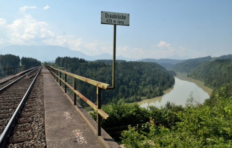
The fifth stage of the Drava Cycle Path R1 (Drauradweg) runs from Ferlach via Völkermarkt to Lavamünd, right through the middle of southern Carinthia. Over around 67 kilometres you follow the Drava through the Jauntal, past conglomerate cliffs, riverside forests and the river’s reservoirs. The nearest access point is on the Drava at Saager (Stein im Jauntal): from there you cycle upstream towards Ferlach or downstream towards Völkermarkt and Lavamünd.
With about 570 metres of ascent and around four and a half hours of actual riding, the whole stage is a full day out for experienced cyclists; shorter sections there and back are also suitable for families. Along the way, the old town of Völkermarkt and the view of the 96-metre-high Jauntal bridge, the highest railway bridge in Central Europe, are well worth it. A detour to one of the swimming lakes brings a welcome cool-down in summer. Take enough water and provisions with you.
April–October
At a glance
Length approx. 67 km, approx. 570 m of ascent
Riding time for the whole stage approx. 4.5 h
Ferlach – Völkermarkt – Lavamünd
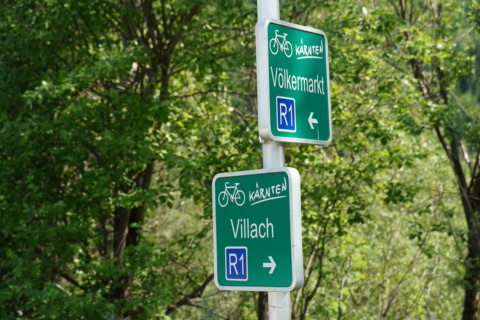
Signposted as R1 (green Carinthian cycle route signs)
Our tip
With the Drauradweg-Bus you can have yourself and your bike taken to the upper reaches and cycle back at your leisure.
For half a day, the section from the access point at Saager to Völkermarkt and back is enough.
Bike tour Bad Eisenkappel – Trögerner Klamm14 km · 50 min by bike · 16 min by carThis bike tour first takes you from Bad Eisenkappel along the Ebriach stream towards the Schaidasattel pass as far as Ebriach/Obirsko.
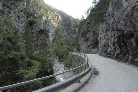
This bike tour first takes you from Bad Eisenkappel along the Ebriach stream towards the Schaidasattel pass as far as Ebriach/Obirsko. At the Gasthof Srienc you turn left into the Trögerner Klamm: a narrow road with hardly any traffic winds through the tight limestone gorge, with the Trögerner Bach rushing along on the left and the rock faces towering up on the right. At the end of the gorge there is a rest stop with a water playground for children, and you return the same way.
The one-way route is just under 12 kilometres with around 270 metres of ascent, spread evenly – so the ride back almost rolls downhill by itself. Allow half a day with breaks. The tour suits families with some cycling experience and e-bikes; as cars use the road too, take care on the blind bends. You can stop for food in Ebriach at the Gasthof Kovac and Gasthof Srienc and at the Jausenstation Rodica in Trögern.
May–October
At a glance
11.9 km one way, around 24 km there and back
Approx. 270 m of ascent, moderate difficulty
Highest point 797 m, mostly asphalt
Return on the same route
Our tip
Bring swimming things or a change of clothes for the children – the water playground at the end of the gorge is perfect for splashing about.
It stays pleasantly cool in the gorge even in high summer – a light jacket for the ride back down is a good idea.
Lavantradweg R10 (Lavamünd – Wolfsberg)40 km · 37 min by carThe Lavantradweg R10 (cycle path) branches off the Drava Cycle Path in Lavamünd and follows the Lavant through the entire Lavanttal to Reichenfels – just under 58 kilometres in all.
The Lavantradweg R10 (cycle path) branches off the Drava Cycle Path in Lavamünd and follows the Lavant through the entire Lavanttal to Reichenfels – just under 58 kilometres in all. For a day trip, the southern section from Lavamünd to Wolfsberg is a good choice: around 29 kilometres, mostly tarmacked and with only gentle climbs, about three hours’ riding time at a relaxed pace. Along the way lie the Benedictine abbey of St. Paul with its art collections, the Mühldorfer Au, a former backwater of the Lavant, and the leisure area at the St. Andräer See.
The destination is Wolfsberg’s old town with cafés and places to eat. The route is family-friendly; just bear in mind that the last few kilometres before Lavamünd have some short climbs and descents. If you carry on beyond Wolfsberg, you have to ride around 10 kilometres on the main road between Wiesenau and Frantschach-St. Gertraud – with children, it’s better to stop there.
April–October
At a glance
Total length approx. 58 km (Lavamünd – Reichenfels)
Lavamünd – Wolfsberg section approx. 29 km, approx. 3 h
Easy, mostly tarmacked
Connects with the Drava Cycle Path R1 in Lavamünd
Our tip
Food and culture stop: Stift St. Paul (Benedictine abbey) lies right on the route, roughly halfway.
The S3 suburban train links Wolfsberg with Kühnsdorf-Klopeinersee station; bikes can travel on Carinthian S-Bahn trains without a reservation as long as there is space.
Cycling: lake tours & Drava Cycle Pathseveral places in the regionAround our house, cycling is pure pleasure: gentle hills, quiet back roads, meadows, woods and a swimming lake every few kilometres.
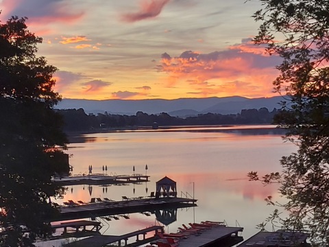
Around our house, cycling is pure pleasure: gentle hills, quiet back roads, meadows, woods and a swimming lake every few kilometres. The popular 3-Lakes Loop (approx. 18 km) runs from the Turnersee via the Kleinsee to the Klopeiner See and starts right outside our front door. If you want more, add the Gösselsdorfer See (4-Lakes Loop, hardly any climbing, ideal for families) or make a whole day of it with the 6-Lakes Loop via the Sonnegger See and Pirkdorfer See. All in all, the region offers around 1,500 kilometres of cycle routes.
North of us, the Drava Cycle Path R1 (Drauradweg) follows the Drava – one of the most beautiful river cycle paths in Europe. Didn’t bring your own bike? E-bikes and bikes can be hired in many places, for example through “Kärnten rent e-Bike”. With the Aktiv Card you can join guided leisurely bike tours and mountain bike tours free of charge – and mountain bikers will find the MTB Zone on the Petzen.
May to September, guided tours too
At a glance
3-Lakes Loop approx. 18 km (Turnersee, Kleinsee, Klopeiner See)
4-Lakes Loop with the Gösselsdorfer See; 6-Lakes Loop approx. 54 km
Around 1,500 km of cycle routes in the region
Drava Cycle Path R1: rated 5 stars by the ADFC (German cyclists’ club)
Kärnten rent e-Bike: approx. 50 rental stations in Carinthia
Guided leisurely bike tours and MTB tours with the Aktiv Card from Bikepoint St. Kanzian
E-bike charging stations: Bike Break at the Turnersee, St. Kanzian tourist information
Our tip
Ride in the morning or late afternoon – in high summer it gets hot at midday.
The leisurely bike tour with the Aktiv Card also picks up participants at Camping Breznik on the Turnersee – approx. 1.3 km from the house.
Guided “difficult” MTB tour with top trails4.2 km · 12 min by bike · 6 min by carFor very fit mountain bikers with confident riding technique: with guide Charly you set off from the Bikepoint at the tourist information office in St. Kanzian along selected natural trails and varied paths through southern Carinthia, with sporty climbs, …Free with Aktiv Card
For very fit mountain bikers with confident riding technique: with guide Charly you set off from the Bikepoint at the tourist information office in St. Kanzian along selected natural trails and varied paths through southern Carinthia, with sporty climbs, flowing descents and wide views. Over around 40–50 km you clock up 700–1,000 metres of climbing, and the tour takes about six hours. Bring a helmet, enough to drink, a packed snack and rain gear. With the Aktiv Card you take part free of charge.
May–October, Thursdays 9:00–15:00 (from September starting at 11:00)
At a glance
40–50 km, 700–1,000 m of climbing
Children aged 12 and over accompanied by an adult
Meeting point: Bikepoint, tourist information, Schulstraße 10, St. Kanzian
Our tip
Sign up by 16:00 the day before, or at short notice directly on the spot.
Rental bikes for adults are limited on site (from €10 per bike, as of 2026), so reserve one when you sign up.
Leisure bike tour – easy (Aktiv Card)4.2 km · 12 min by bike · 6 min by carOn this leisurely guided bike tour you ride with guide Charly along well-made cycle paths through the lakes and rolling hills of southern Carinthia, with a refreshment stop on the way.Free with Aktiv Card
On this leisurely guided bike tour you ride with guide Charly along well-made cycle paths through the lakes and rolling hills of southern Carinthia, with a refreshment stop on the way. The start is at the Bikepoint of the tourist information in Seelach; you can join about 20 minutes later at Camping Breznik on the Turnersee. Suitable for adults and children from 12 with some cycling experience – please bring a helmet, water bottle and sun protection.
July–August, Tuesdays 14:00–17:00
At a glance
30–45 km, 300–500 m of climbing, approx. 3 h
Meeting point Bikepoint, tourist information St. Kanzian, Schulstraße 10; joining at Camping Breznik approx. 20 min later
Free with the Aktiv Card; limited rental bikes for adults from €10 (as of 2026)
From 12 years, accompanied by an adult
Our tip
Register by 16:00 the day before at the tourist information – late sign-ups on the spot are often possible too.
The joining point at Camping Breznik on the Turnersee is an easy walk from us.
Leisure bike tour – intermediate (Aktiv Card)4.2 km · 12 min by bike · 6 min by carWith bike guide Charly you cycle along the extensive cycle path network of southern Carinthia to scenic and cultural sights in the region – churches, viewpoints, lakes and villages in the Jauntal.Free with Aktiv Card
With bike guide Charly you cycle along the extensive cycle path network of southern Carinthia to scenic and cultural sights in the region – churches, viewpoints, lakes and villages in the Jauntal. Halfway through, a stop at a Buschenschank (farm tavern) or an inn is part of the tour. It takes half a day and suits anyone who cycles regularly and doesn’t mind a few climbs.
June–September, Fridays 10:00–14:30 (from September starting at 11:00)
At a glance
30–45 km, 300–500 m of climbing, 10:00–14:30 (from 7 September starting at 11:00)
Meeting point Bikepoint, tourist information St. Kanzian, Schulstraße 10
Free with the Aktiv Card; limited rental bikes for adults from €10 (as of 2026)
From 12 years, accompanied by an adult
Our tip
Register by 16:00 the day before; bring some cash for the refreshment stop.
Intermediate MTB tour with guaranteed trails (Aktiv Card)4.2 km · 12 min by bike · 6 min by carThis guided mountain bike tour with guide Charly is meant for experienced riders with a good basic level of fitness.Free with Aktiv Card
This guided mountain bike tour with guide Charly is meant for experienced riders with a good basic level of fitness. Over 30–40 km and 500–700 metres of climbing, you ride selected natural trails and forest tracks in the hill country of southern Carinthia, with views across the region again and again along the way. Allow around four hours. The meeting point is the Bikepoint at the St. Kanzian tourist information office.
May–October, Wednesdays 9:00–13:00 (from September starting at 11:00)
At a glance
30–40 km, 500–700 m of climbing
Children aged 12 and over accompanied by an adult
Limited rental bikes for adults on site, from €10 (as of 2026)
Our tip
Sign up by 16:00 the day before; at short notice it is often still possible on the spot.
Pack a snack, plenty of water and a spare inner tube.
Mountain bike tour for beginners (Aktiv Card)4.2 km · 12 min by bike · 6 min by carOn this guided tour for beginners you gain your first off-road experience with guide Charly.Free with Aktiv Card
On this guided tour for beginners you gain your first off-road experience with guide Charly. The route follows varied forest tracks and selected easy natural trails around the Klopeiner See, with tips on riding technique and safe biking along the way. At 20–25 km and 250–400 metres of climbing, the loop takes a good two hours; an e-bike makes the climbs easier. The meeting point is the Bikepoint at the St. Kanzian tourist information office.
May–October, Tuesdays 9:00–11:30 (from September starting at 11:00)
At a glance
20–25 km, 250–400 m of climbing
Children aged 12 and over accompanied by an adult
Limited rental bikes for adults on site, from €10 (as of 2026)
Our tip
Sign up by 16:00 the day before; at short notice it is often still possible on the spot.
MTB Flow Trail Steinerberg2.3 km · 31 min on foot · 8 min by bike · 4 min by carOn the Steinerberg near St. Kanzian, the tourist board has built a short flow trail for families and beginners.
On the Steinerberg near St. Kanzian, the tourist board has built a short flow trail for families and beginners. The descent, around 1.4 km long with about 67 metres of drop, runs through the forest on a firm surface over rollers, berms and short uphill sections. The small tables can be ridden around, and faster riders can jump them. Use of the trail is free and at your own risk.
The start is opposite the Zum Grinzing wine tavern (Heuriger). You ride back up under your own steam, and many people ride the trail several times in a row. For children who can already ride confidently, the trail is ideal for practising before you go on longer rides together. The Kitzelberg trail is nearby and combines well with it. The surface dries quickly after rain.
May–October
At a glance
Approx. 1.4 km, around 67 m of descent
Free, use at your own risk
1 May – 31 August 9:00–19:00, 1 September – 31 October 9:00–17:00
Parking at the Zum Grinzing wine tavern (Heuriger) or at the St. Kanzian tourist information office
Our tip
Helmet and gloves are compulsory for children and highly recommended for adults.
Ride the trail slowly first to get to know the tables and berms.
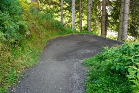
Unterburg pump track at the Klopeiner See6.1 km · 19 min by bike · 7 min by carIn Unterburg on the east shore of the Klopeiner See there is a small pump track, a loop of rollers and banked corners built in 2016.
In Unterburg on the east shore of the Klopeiner See there is a small pump track, a loop of rollers and banked corners built in 2016. Children on BMXs, balance bikes or kids’ bikes practise building speed here without pedalling, and the track is good for half an hour in between. It is freely accessible near the Café Zum Poldi and the Strandbad Krainz. A helmet is a must, and the track is slippery after rain. We have not been able to check how well kept it is in 2026.
April–October, in dry weather
At a glance
Built in 2016, small roller track for BMXs and kids’ bikes
Unterburg, east shore of the Klopeiner See
Freely accessible, free of charge
Our tip
If the track is not in good condition, you’ll find a bigger pump track at the Bike Break at the Turnersee.
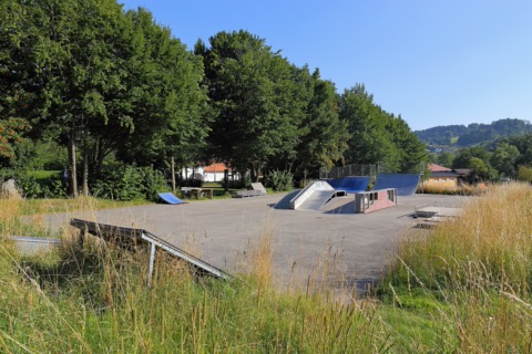
The public skate park of the town of Völkermarkt is next to the sports stadium on Jahnweg. There’s a halfpipe, quarterpipe, wheel base, rail slide and fun box – elements for skateboards, scooters and BMX. The park is open to everyone and free to use. For teenagers it’s a good change from a day at the lake. Bring a helmet and pads.
April–October (in dry weather)
At a glance
Halfpipe, quarterpipe, wheel base, rail slide, fun box
Freely accessible, free of charge
By the sports stadium, Jahnweg, Völkermarkt
Town council contact: +43 4232 2571-25
Our tip
Plan your visit for the morning or late afternoon – at midday the surface gets very hot in the sun.
Flow Country Trail Petzen24 km · 29 min by carThe Flow Country Trail in the MTB Zone Bikepark Petzen is 11.5 km long and one of the longest flow trails in Europe.Discount with Aktiv Card
The Flow Country Trail in the MTB Zone Bikepark Petzen is 11.5 km long and one of the longest flow trails in Europe. You ride the gondola up to the top station at about 1,700 m and then roll some 1,000 vertical metres back down into the valley near Feistritz ob Bleiburg over berms, rollers and tables. The middle section has lots of tables; lower down the trail runs more gently across meadows. Every jump can be rolled, and there are rest and pull-out spots along the way.
The trail is easy to intermediate, so it also suits confident hobby riders and teenagers trying a bike park for the first time. One descent takes half an hour to an hour, depending on your pace. You can hire bikes, protective gear and helmets at the bike shop at the valley station, which also handles small repairs. A full-face helmet and protective gear are recommended.
May–October (usually Thu–Sun, daily in the school holidays)
At a glance
Length 11.5 km, about 1,000 m of descent
Difficulty easy to intermediate
Start at the top station (approx. 1,700 m), up by gondola
Rental and workshop at the valley station
Lift 9:00–16:15 (last ride up)
Our tip
The trails are closed daily from 17:00 to 9:00, so plan your last run in good time.
Check the trail status on the bike park website before you set off – the lift stops during thunderstorms or technical faults.
On the Petzen near Feistritz ob Bleiburg lies one of the best-known bike parks in Austria. Its centrepiece is the Flow Country Trail: 11.5 kilometres of tables, berms and steep banked turns, with every jump rollable, graded easy to intermediate. Very experienced riders take the Thriller or the EWS Trail, where World Cup races have already been held. Since 2025 there have also been a Jump Trail, Freeride and Shakedown Trail at the Quellenlift. You get up the mountain by cable car or the Quellenlift.
For children and beginners there is a practice course in the valley and the short, 350-metre Kids Naturtrail through the woods. At the bike station by the valley station you can hire enduro and junior bikes including helmet and protectors, and riding technique courses are offered for children, teenagers and adults. A full-face helmet and protectors are recommended on all trails. Allow half a day to a full day.
May to early November (autumn Thu–Sun, daily in the school holidays), 9:00–16:30
At a glance
Flow Country Trail: 11.5 km, easy to intermediate
Kids Naturtrail 350 m, practice course in the valley
Day pass adults €49.50, children up to 15 €27.50 (as of 2026)
Rental enduro bike €65 per day (as of 2026)
Trails closed daily 17:00–9:00 for maintenance
Our tip
Rental bikes are in demand – book ahead; at short notice (24 hours before) only by phone on +43 4235 2246 35.
Check the trail status on the website before you set off – individual trails are sometimes closed because of the weather.
With the Aktiv Card adults get 20% off a return ticket on the cable car; bike park tickets are not explicitly mentioned in the leaflet.
Petzen Easyloop: Jump Trail, Freeride & Shakedown24 km · 29 min by carRight by the valley station of the Petzen cable car in Feistritz ob Bleiburg lies the Quellenhang slope.
Right by the valley station of the Petzen cable car in Feistritz ob Bleiburg lies the Quellenhang slope. Since 2025 the Quellenlift, a T-bar lift about 530 metres long, takes you and your bike back up again – the so-called Easyloop system. From the top, three short trails lead back down: a Jump Trail built for jumps, a Freeride line and the Shakedown Trail. Because the laps are short, you can ride the same line several times in a row and practise specific skills without taking the gondola up to 1,700 metres every time.
The trails are aimed at teenagers and adults with some bike park experience; complete beginners start on the practice course in the valley, and for children there is the Kids Natur Trail. At the bike shop by the valley station you can hire bikes, helmets and protectors and have small repairs done, and there is a bike wash next to it. If you want more afterwards, take the gondola up to the long Flow Country Trail.
Summer season May to end of October, depending on lift and trail status
At a glance
3 trails at the Quellenlift: Jump Trail, Freeride, Shakedown (new since 2025)
Uplift with the Quellenlift (T-bar lift, approx. 530 m)
Trails closed daily 17:00–9:00 for maintenance
Hire of bikes, helmets and protectors at the valley station
Our tip
Check the live status on petzen.net before you set off, or call +43 4235 2246 – the lift and the trails are not always open at the same time.
Helmet and protectors are no exaggeration here; if you don’t have your own, hire them at the bike shop.
Petzen Thriller & EWS Trail (Bikepark Petzen)24 km · 29 min by carBesides the well-known Flow Country Trail, the MTB Zone Bikepark Petzen has two trails for experienced enduro riders: the Petzen Thriller is a natural trail with roots, rocks and steep sections that drops almost 1,000 metres over about 5 kilometres from the …
Besides the well-known Flow Country Trail, the MTB Zone Bikepark Petzen has two trails for experienced enduro riders: the Petzen Thriller is a natural trail with roots, rocks and steep sections that drops almost 1,000 metres over about 5 kilometres from the top station down to the valley. The EWS Trail was built in 2018 specially for a round of the Enduro World Series and joins the Thriller – technically demanding and at race level.
You take the cable car up with your bike and ride back down to the valley; depending on your fitness you can manage several descents in a morning. The trails are expressly meant only for experienced riders, with a full-face helmet and protectors. If you don’t bring your own enduro or downhill bike, you can hire a bike, helmet and protective gear at the bike shop by the valley station; there is also a bike wash there.
May to early November, in spring and autumn usually Thu–Sun, daily in summer (when the cable car runs)
At a glance
Thriller: natural trail, approx. 5 km, almost 1,000 m of descent
EWS Trail: built in 2018 for the Enduro World Series
Cable car 9:00–16:30 (last ride up 16:15)
Trails closed daily 17:00–9:00 for maintenance
Hire and small repairs at the bike shop by the valley station
Our tip
Check the trail lights on petzen.net in the morning – Thriller and EWS are often closed when wet or during works, while the practice trails stay open.
If you don’t know the Petzen yet, ride the Flow Country Trail first to get a feel for the terrain and your brakes.
Practice course, Kids Natur Trail & Quellenlift trails (Bikepark Petzen)24 km · 29 min by carDown in the valley of the MTB Zone Bikepark Petzen, beginners and children can practise in peace before tackling the long descents: the practice course with small rollers, bends and obstacles is right by the valley station, and the Kids Natur Trail takes …
Down in the valley of the MTB Zone Bikepark Petzen, beginners and children can practise in peace before tackling the long descents: the practice course with small rollers, bends and obstacles is right by the valley station, and the Kids Natur Trail takes children playfully over forest floor and roots.
Since 2025 there have been three more trails at the Quellenlift in the valley – Jump Trail, Freeride and Shakedown – which you reach comfortably by lift instead of the cable car. For one to three hours this makes a good outing for families and for more advanced riders who want to practise jumps. Bikes, helmets and protectors in children’s sizes are available at the bike shop by the valley station; there is a bike wash right next to it.
May to early November, in spring and autumn usually Thu–Sun
At a glance
Practice course and Kids Natur Trail in the valley by the valley station
Quellenlift trails since 2025: Jump Trail, Freeride, Shakedown
Rental bikes and protective gear at the valley station
Trails closed daily 17:00–9:00
Our tip
The valley trails are often open even when the cable car isn’t running or the long trails are closed – it’s worth checking the trail lights on petzen.net.
Helmet and gloves are compulsory for children on the practice course too – hire them at the bike shop if needed.
lake’n’ride – bike hire at the Klopeiner See3.4 km · 9 min by bike · 4 min by carOn the west shore of the Klopeiner See in Seelach, lake’n’ride hires out e-bikes, gravel bikes, mountain bikes, full-suspension e-MTBs, trekking bikes and children’s bikes – by the hour, day or week.
On the west shore of the Klopeiner See in Seelach, lake’n’ride hires out e-bikes, gravel bikes, mountain bikes, full-suspension e-MTBs, trekking bikes and children’s bikes – by the hour, day or week. You can hire a helmet and child seat as extras, and a lock comes with every rental bike. Bikes can be reserved online or by phone, which is advisable in high season. Repairs and servicing are handled by partner workshops.
Mid-May–end of September
At a glance
Westuferstraße 42, 9122 St. Kanzian (Seelach)
Mid-May–end of September daily 8:00–12:00 and 14:00–18:00, Sundays and public holidays too
E-bike/gravel: €30 for 3 hours, €40 per day (as of 2026)
Phone 0676 6300563
Our tip
For July and August, it’s best to reserve e-bikes online a few days in advance.
Bikepoint at the St. Kanzian tourist office4.2 km · 12 min by bike · 6 min by carThe region’s guided bike tours start from the Bikepoint in front of the tourist office in Seelach: from the leisurely guided bike tour with a stop for food to MTB riding-technique training and sporty trail tours with guide Charly.Free with Aktiv Card
The region’s guided bike tours start from the Bikepoint in front of the tourist office in Seelach: from the leisurely guided bike tour with a stop for food to MTB riding-technique training and sporty trail tours with guide Charly. With the Aktiv Card you take part free of charge. Sign up by 16:00 the day before, or at short notice on the spot. There is a limited number of rental bikes for adults. At the tourist office you can also pick up cycling maps and tour tips.
June–September (guided tours) · Guided tours June to September: Mon riding technique & kids’ tour, Tue MTB for beginners and easy leisure bike tour, Wed MTB intermediate, Thu MTB difficult, Fri intermediate leisure bike tour
At a glance
Schulstraße 10, 9122 St. Kanzian (Seelach)
Guided tours June–September, Mon–Fri depending on the tour
Rental bike for adults from €10 (as of 2026, limited number)
Tours 10–50 km, children from 8 or 12 years depending on the tour
Our tip
If you need a rental bike, reserve it when you sign up the day before – the bikes go quickly.
From 7 September most tours don’t start until 11:00.
enJOY E-Bikes – rental and service4.6 km · 14 min by bike · 6 min by carThis e-bike shop on Klopeiner Straße in St. Kanzian rents out e-city, e-trekking, e-mountain and full-suspension bikes, plus ordinary bikes, children’s bikes and accessories such as helmets, child seats, trailers and spare batteries – by the hour, for half or …
This e-bike shop on Klopeiner Straße in St. Kanzian rents out e-city, e-trekking, e-mountain and full-suspension bikes, plus ordinary bikes, children’s bikes and accessories such as helmets, child seats, trailers and spare batteries – by the hour, for half or full days and for up to a week. Bikes are handed out from 8:30 and must be returned by 18:00. There is also a workshop offering quick repairs, including for other brands.
April–October
At a glance
Klopeiner Straße 20, 9122 St. Kanzian
E-bike from €19/hour, €38/day, full-suspension €49, ordinary bike €23 (as of 2026)
Pick-up from 8:30, return by 18:00
Tel. +43 664 4627208
Our tip
Bring an official photo ID and a €30 cash deposit per bike.
In high season, reserve in advance by phone or via the enquiry form, giving your height.
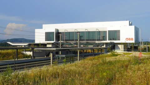
Rail & Bike from Kühnsdorf-Klopeiner See station9.2 km · 30 min by bike · 10 min by carSince the Koralmbahn opened, Kühnsdorf-Klopeiner See station has been a good starting point for bike tours with a little help from the train: you take the S-Bahn with your bike to Klagenfurt or the Lavanttal, for example, and cycle back.
Since the Koralmbahn opened, Kühnsdorf-Klopeiner See station has been a good starting point for bike tours with a little help from the train: you take the S-Bahn with your bike to Klagenfurt or the Lavanttal, for example, and cycle back. As long as there are spaces free, you don’t need a reservation on the S-Bahn. With the Aktiv-Ticket Kärnten, you and your bike can travel on local trains for a whole day.
All year, for bike tours mainly April–October
At a glance
S-Bahn Kärnten: up to 24 bikes per train, no reservation needed
Aktiv-Ticket Kärnten: €19.90, children €12.90, bike included (as of 2026)
Ticket valid on S-Bahn, regional trains and REX, not on Railjet/IC
Kühnsdorf-Klopeiner See station, 9125 Kühnsdorf (municipality of Eberndorf)
Our tip
Buy the Aktiv-Ticket in advance in the ÖBB app; there is only a ticket machine at the station.
On sunny summer weekends, take an earlier train so there are still bike spaces free.
Drava Cycle Path bus (Kärnten Radreisen)Pick-up in the regionWith the Drauradweg-Bus from Kärnten Radreisen you ride the Drava Cycle Path downstream instead of uphill: an air-conditioned minibus with a bike trailer takes you on Fridays and Saturdays from the Klopeiner See to Lienz or Sillian in East Tyrol.
Please check the opening times with the venue before you go.
With the Drauradweg-Bus from Kärnten Radreisen you ride the Drava Cycle Path downstream instead of uphill: an air-conditioned minibus with a bike trailer takes you on Fridays and Saturdays from the Klopeiner See to Lienz or Sillian in East Tyrol. From there you cycle back along the Drava in several daily stages. The bus only runs if there are bookings, so reserve in good time by e-mail or phone. For four people or more, your own dates with pick-up at your accommodation are also possible.
Summer, Fri & Sat (only when booked) · Summer, Fridays and Saturdays (only when booked)
At a glance
Fri & Sat, only when booked; for 4 people or more on a date of your choice
Minibus for up to 8 people with bike trailer
Stops: Lavamünd, Klopeiner See, Villach, Lienz, Sillian/Toblach
Klopeiner See–Lienz €99, –Sillian €109 per person, own bike +€25 (as of 2026)
Our tip
For the ride back from Lienz to the Klopeiner See (just under 200 km of cycle path) you should allow three to four days.
When booking, ask for the exact pick-up point at the Klopeiner See or for pick-up at your accommodation.
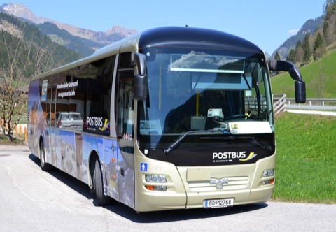
Postbus Shuttle Southern Carinthia with bike transportOn-demand bus in the regionThe Postbus Shuttle is an on-demand bus for St. Kanzian, Eberndorf, Bleiburg and Feistritz ob Bleiburg: you book your ride in the app and are picked up at any stop in the area.
The Postbus Shuttle is an on-demand bus for St. Kanzian, Eberndorf, Bleiburg and Feistritz ob Bleiburg: you book your ride in the app and are picked up at any stop in the area. Since July 2026 it also takes bikes Fri–Sun from 8:00 to 18:00, for example to the Eckwirt in St. Primus, to the Hafenrast on the Drava Cycle Path in Völkermarkt or to the Mostschenke at the Linsendorfer See – handy for one-way bike tours.
All year; bike transport July to end of September, Fri–Sun 8:00–18:00
At a glance
Booking via the Postbus Shuttle app, up to 30 days in advance
Summer service (mid-May–mid-Sep): Fri/Sat until 2:00
Kärntner Verkehrsverbund (Carinthian public transport) fare + €2 comfort surcharge, bike + €5 (as of 2026)
Our tip
Add the bike straight away when you book in the app – you can also book by phone via the Postbus office in Kühnsdorf (+43 664 624 83 15).
With a Klimaticket or Carinthia annual pass you only pay the comfort surcharge.