A whole day across the border: the Logartal just across the border, Bled and the Soča Valley, Ljubljana, Tarvisio and Friuli – all the way to the sea and Venice.
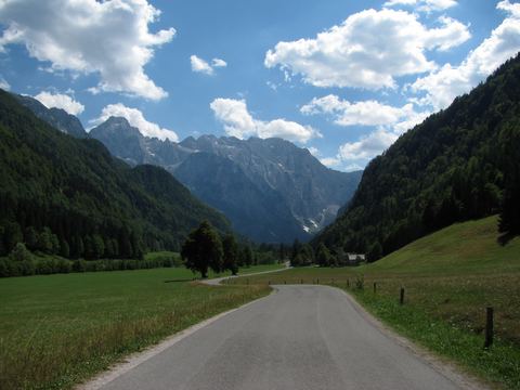
Logartal (Logarska dolina)47 km · 59 min by carThe Logartal in the Kamnik Alps is considered one of the most beautiful glacial valleys in Europe – and it is surprisingly close.
The Logartal in the Kamnik Alps is considered one of the most beautiful glacial valleys in Europe – and it is surprisingly close. Via Bad Eisenkappel and the Paulitschsattel (approx. 1,340 m), whose summit marks the border, you reach the valley near Solčava in about an hour. The pass road is narrow and winding – take your time, the scenery is worth every minute.
In the valley a toll road leads between alpine meadows and sheer rock faces to the head of the valley. From there it is only about 10–20 minutes’ walk to the Rinka waterfall, around 90 metres high and one of the highest free-falling waterfalls in Slovenia. The valley has more waterfalls, such as the Palenk falls, and simple inns serving home-style Slovenian food. Pedestrians and cyclists pay no toll.
At its best from May to September
At a glance
Rinka waterfall approx. 90 m, natural monument
Approach via the Paulitschsattel (Pavličevo sedlo), approx. 1,340 m
Toll for cars in the landscape park; free for pedestrians and cyclists
Our tip
Set off early – it is quieter in the morning.
Bring cash for the toll and your ID card or passport.
Alternative route back via the Seebergsattel and Jezersko.
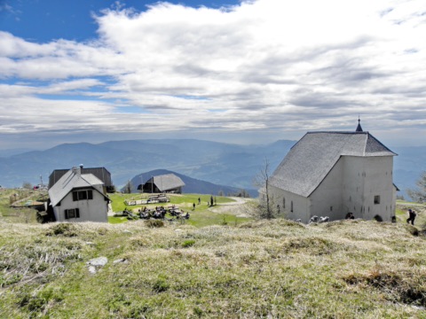
At 1,699 metres, the Uršlja gora is the easternmost summit of the Karawanks. Just below the summit stands the church of St Ursula, begun in 1584, which gives the mountain its name; right next to it are the mountain hut Dom na Uršlji gori and a TV transmitter. The panoramic view stretches across the Mießtal and the Carinthian lowlands to the Petzen, the Bachern (Pohorje) and the Kamnik Alps (Steiner Alpen).
A convenient starting point is the hut Koča na Naravskih ledinah (1,072 m) above Črna na Koroškem, which you can reach by car. From there a marked, easy path leads across meadows, through patches of forest and along a forest track onto the west ridge and to the summit in about an hour and a half, around 600 metres of ascent. You return the same way. Allow three to four hours including a break; sturdy shoes and a jacket for the often windy summit are a must.
May–October
At a glance
Summit 1,699 m, easternmost peak of the Karawanks
Church of St Ursula at 1,696 m, begun in 1584
Ascent from Naravske ledine approx. 1.5 h, about 600 m of ascent
Mountain hut Dom na Uršlji gori (1,680 m) right next to the church
Our tip
Check with the Črna na Koroškem tourist office beforehand whether the summit hut is open.
From Naravske ledine you can go first to the hut or straight to the summit, making a small loop.
Mozirski gaj – flower park in Mozirje76 km · 1 h 30 min by carOn the right bank of the Savinja in Mozirje, gardeners and locals have turned an overgrown village pasture into a flower park of around 7 hectares since the 1980s.
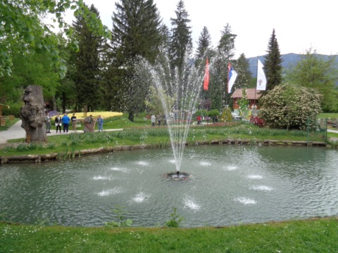
On the right bank of the Savinja in Mozirje, gardeners and locals have turned an overgrown village pasture into a flower park of around 7 hectares since the 1980s. You stroll past flowerbeds, a herb garden and a Japanese garden, a rock garden and avenues. In between there is a small open-air museum with granaries, a farmhouse, a smithy, water mills, a sawmill and a hayrack (harpfe). In the “magic village” with its fairy-tale cottages, children can let off steam. Allow two to three hours for a walk round.
The programme changes with the seasons: the big tulip show in spring, exhibitions such as the Bioexo exotic-animal show in summer, giant pumpkins and autumn flowers in autumn. From late November to early January, around two million lights glow in the park in the evenings at the “Božična bajka Slovenije”. The park lies in the upper Savinja valley. Add a detour to the Logartal and you have a day trip.
Mid-April – mid-October; park of lights late November – early January
At a glance
Around 7 ha, flower park and open-air museum
Season roughly mid-April to mid-October, plus a park of lights in Advent
Park of lights late November to early January, daily 16:00–21:00
Admission adults €11, children aged 7–14 €6 (as of 2026)
Cash only at the ticket office, tickets can be bought online
Our tip
Bring cash or buy your tickets online in advance.
Come in spring for the tulip show or in September for the pumpkin show – that is when the most is blooming and growing.
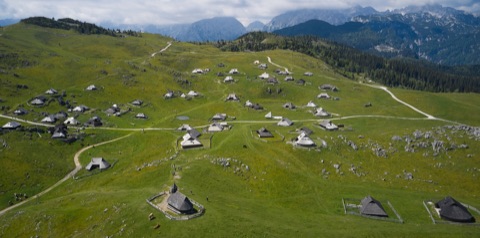
Velika planina – cable car to the herdsmen’s pasture84 km · 1 h 45 min by carVelika planina (the “Big Pasture”) is a high alpine pasture at around 1,400 to 1,666 metres on the southern edge of the Kamnik Alps, above Kamnik.
Velika planina (the “Big Pasture”) is a high alpine pasture at around 1,400 to 1,666 metres on the southern edge of the Kamnik Alps, above Kamnik. It is known for its herdsmen’s settlements: oval, shingle-roofed wooden huts with deep, low-slung roofs that are traditionally lived in from June to September. In the middle stands the little chapel of Maria Schnee (Our Lady of the Snows), built in 1938 to plans by Jože Plečnik. In the Preskar hut, a small museum, you can see how the herdsmen used to live and make cheese.
From the Kamniška Bistrica valley an aerial cable car takes you up to the pasture in five minutes. From there you continue on foot (about 30 minutes) or by chairlift to Gradišče, the highest point, and then down along pasture paths to the herdsmen’s settlement. Allow half a day to a full day. In summer the staffed huts serve soured milk, žganci and the pear-shaped trnič cheese. Sturdy shoes and a jacket are a good idea even in high summer.
All year (maintenance closure mid-Oct–mid-Nov), pasture season June–September
At a glance
Aerial cable car from Kamniška Bistrica (since 1964), ride approx. 5 min
Six-seater chairlift Šimnovec to Gradišče (1,666 m), since December 2024
Herdsmen’s settlement with oval wooden huts and Plečnik chapel (1938)
Annual maintenance closure mid-October to mid-November
Our tip
Go early in the day – on summer weekends queues form at the valley station.
Try trnič, the pasture’s traditional herdsmen’s cheese, in one of the huts.
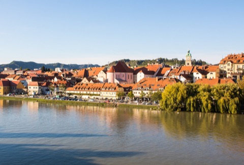
Maribor – Lent and the Old Vine111 km · 1 h 55 min by carMaribor, Slovenia’s second-largest city, lies on the Drava like Völkermarkt, just over an hour downstream.
Maribor, Slovenia’s second-largest city, lies on the Drava like Völkermarkt, just over an hour downstream. In Lent, the old harbour and rafters’ quarter on the north bank, the “Stara trta” grows up the wall of a house. The Old Vine is over 400 years old and is considered the oldest vine in the world still bearing fruit. In the Old Vine House right next to it you can learn more about winegrowing in Štajerska and taste regional wines. Afterwards, stroll along the riverside promenade to the old defensive towers (Sodni stolp, Vodni stolp) and up into the car-free old town around Glavni trg and Grajski trg with its castle and cathedral.
Allow half a day to a full day for the city. The routes are flat and short, and the Old Vine House and the museums are also a good choice on rainy days. If you have more time, have lunch in Lent in one of the gostilnas by the water, or drive out in the afternoon to Pohorje, the city’s local mountain on its outskirts.
All year
At a glance
Old Vine (Stara trta): over 400 years old, Žametovka/Blauer Kölner variety
Old Vine House: Vojašniška ulica 8, with wine tasting
Festival Lent city festival every year in late June/early July
Getting there via the motorway into Slovenia: vignette required
Our tip
Park in one of the underground car parks on the edge of the old town and explore Lent and the old town on foot.
In late September or early October the Old Vine is ceremonially harvested – well worth a trip.
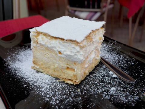
Bled cream cake at Café Park77 km · 1 h 20 min by carThe Bled cream cake (Blejska kremna rezina or kremšnita) was invented in 1953 in the pastry kitchen of the Hotel Park and is still baked to that recipe today: a crisp puff-pastry base, a thick layer of vanilla cream, whipped cream on top and a puff-pastry lid …
The Bled cream cake (Blejska kremna rezina or kremšnita) was invented in 1953 in the pastry kitchen of the Hotel Park and is still baked to that recipe today: a crisp puff-pastry base, a thick layer of vanilla cream, whipped cream on top and a puff-pastry lid dusted with icing sugar. The best place to eat it is Café Park (Kavarna Park) right on the lakeside promenade, on the terrace with a view across the lake to the island. A slice is a cube of about 7 cm – but it is rarely enough to share.
All year
At a glance
Made to the original Hotel Park recipe since 1953
Kavarna Park, Cesta svobode 15, 4260 Bled
More than 16 million slices sold
Cube of approx. 7 × 7 × 7 cm
Our tip
Combine the cream cake with a walk around the lake (approx. 6 km) – the terrace is often full in the afternoon, it’s easier to get a seat in the morning.
You can recognise the real thing by the cream wobbling slightly when the plate is set down.
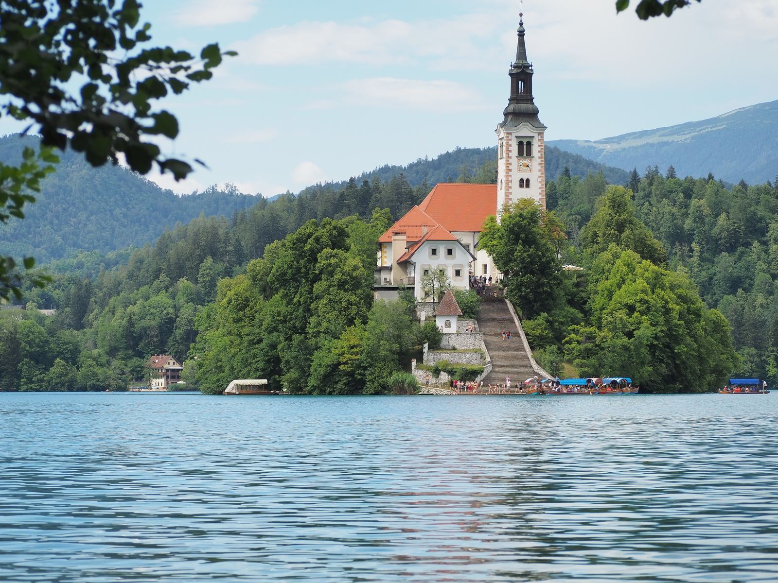
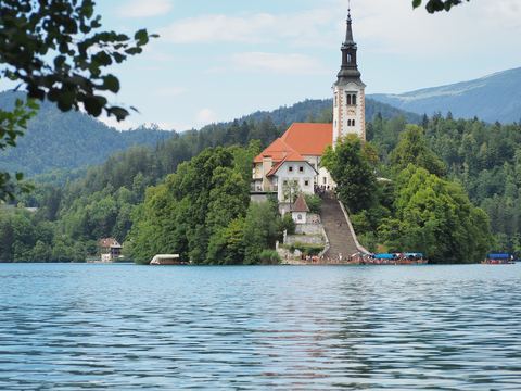
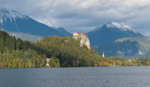
Bled & Lake Bled78 km · 1 h 20 min by carLake Bled with its little island and pilgrimage church, and above it the castle on a rock – hardly any view is as typical of Slovenia.
Lake Bled with its little island and pilgrimage church, and above it the castle on a rock – hardly any view is as typical of Slovenia. From our house you can reach Bled in about an hour and a half, either over the Loibl Pass or on the motorway through the Karawanks Tunnel. A “pletna”, a hand-rowed wooden boat, takes you across to the island, where according to tradition you ring the bell to make a wish.
A walk around the lake takes about an hour and a half and offers ever-changing views of the castle and the Julian Alps. Be sure to try the famous Bled cream cake (“kremšnita”). Nearby is the Vintgar Gorge, a gorge with wooden walkways. Slovenia’s motorways require their own vignette, and the Karawanks Tunnel has an additional toll – the route over the Loibl Pass is toll-free and very scenic.
All year, at its best in early and late summer
At a glance
Island with pilgrimage church, pletna boats
Bled Castle above the lake
Lakeside circular path approx. 6 km
Slovenian motorway vignette required; separate toll for the Karawanks Tunnel
Our tip
Travel over the Loibl Pass – toll-free and scenic.
Bled Castle (Blejski grad)80 km · 1 h 25 min by carBled Castle is perched on a sheer cliff about 130 metres above Lake Bled and was first mentioned in records as early as 1011 – it is considered the oldest castle in Slovenia.
Bled Castle is perched on a sheer cliff about 130 metres above Lake Bled and was first mentioned in records as early as 1011 – it is considered the oldest castle in Slovenia. Across two castle courtyards you reach the castle museum with finds on the history of the region, the castle chapel, the reconstructed printing workshop from Gutenberg’s time with demonstrations on hand-made paper, the wine cellar and the STOLP gallery. From the terrace you look down on the island with its pilgrimage church and across to the Julian Alps.
Allow about one to two hours for the castle itself; combined with a walk around the lake or a pletna boat ride to the island, it makes a full day out. On foot you climb up from the lakeshore on steep woodland paths in about 15 to 20 minutes; by car you reach paid car parks just below the castle. Comfortable shoes are recommended for the paths and the cobblestones.
All year (April–October 8:00–20:00, November–March 8:00–18:00)
At a glance
First mentioned in 1011, oldest castle in Slovenia
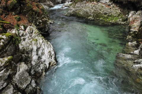
Vintgar Gorge near Bled80 km · 1 h 25 min by carJust a few kilometres from Bled, the Radovna river has cut its way through the rock and formed the Vintgar Gorge.
Just a few kilometres from Bled, the Radovna river has cut its way through the rock and formed the Vintgar Gorge. For around 1.6 kilometres, wooden walkways and bridges lead through the gorge just above the turquoise-green water, past rapids and deep pools, to the roughly 15-metre Šum waterfall at the end. The path is one-way and easy for children; expect to spend about an hour in the gorge.
By car you drive to the central Vintgar Lip car park in Bled, where parking is included in the ticket; from there an electric shuttle takes you to the entrance in about 20 minutes. Visitor numbers are limited per time slot, so book your ticket online in advance and be at the car park at least 40 minutes before your chosen time. No tickets are sold at the entrance. The gorge combines well with a visit to Lake Bled.
April–late autumn
At a glance
1.6 km of wooden walkways, one-way path
Šum waterfall approx. 15 m
Timed ticket, book online; parking at P1 Vintgar Lip included
Season approx. April to late autumn
Our tip
Book an early time slot – the walkways are much quieter then.
Bring non-slip shoes and a light jacket – it is damp and cool in the gorge.
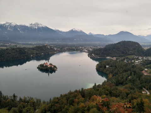
Mala Osojnica – viewpoint above Lake Bled80 km · 1 h 25 min by carYou get the famous postcard view of Lake Bled – the island with its pilgrimage church, the castle on its rock behind it and the Julian Alps beyond – from the Mala Osojnica on the western shore of the lake.
You get the famous postcard view of Lake Bled – the island with its pilgrimage church, the castle on its rock behind it and the Julian Alps beyond – from the Mala Osojnica on the western shore of the lake. The starting point is Velika Zaka by Camping Bled. The path is short but steep: around 200 metres of ascent over rooty trails and steps and, at the end, a steep metal staircase and ladders; allow 30 to 45 minutes for the climb.
If you have more time, combine the Mala Osojnica with the lower neighbouring summit of Ojstrica into a loop of about two hours. Many people climb the Mala Osojnica first, because going down the ladders is trickier than going up. Sturdy footwear and sure-footedness are essential; the path is not suitable for small children or in wet conditions. Early morning is ideal, when the light falls on the island and castle from the east.
All year, in dry weather
At a glance
Ascent approx. 30–45 min, approx. 200 m of climbing
Steep stairs and ladders in the upper section
Can be combined with the Ojstrica (loop approx. 2 h)
No admission charge; paid parking at Velika Zaka
Our tip
Go early in the morning – the light is at its best and it is still quiet.
Better give it a miss in rain or when the ground is wet; the ladders get slippery.
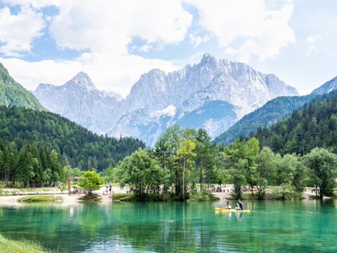
Kranjska Gora & Lake Jasna92 km · 1 h 25 min by carKranjska Gora is the best-known mountain resort in the Slovenian Julian Alps and lies in the upper Sava valley, close to the point where Austria, Italy and Slovenia meet.
Kranjska Gora is the best-known mountain resort in the Slovenian Julian Alps and lies in the upper Sava valley, close to the point where Austria, Italy and Slovenia meet. Just south of the village, at the start of the road up to the Vršič Pass, lies little Lake Jasna: the clear, turquoise water in front of the rock faces of Prisojnik and Razor, a wooden bridge and the bronze statue of Zlatorog, the legendary ibex, make it a popular photo spot. A level path leads around the lake, and on hot days people swim and picnic on the shore.
In the village itself, a stroll through the centre with its church and cafés is worthwhile. If you want to go further, drive up the Vršič Pass road with its 50-plus numbered hairpin bends to 1,611 metres and past the Russian Chapel – or down into the Soča valley. Allow half a day for Kranjska Gora and the lake, a whole day with the pass.
All year, swimming July–August
At a glance
Lake Jasna at the start of the Vršič Pass road, approx. 10 minutes’ walk from the village centre
Zlatorog ibex statue on the lakeshore
Vršič Pass 1,611 m, 50-plus hairpin bends
Getting there via Villach and the Wurzenpass or the Karawanks Tunnel
Our tip
In summer come in the morning – the car parks by the lake are often full by midday.
Bring your swimming things: the water is fresh, but on warm days it’s great for cooling off.
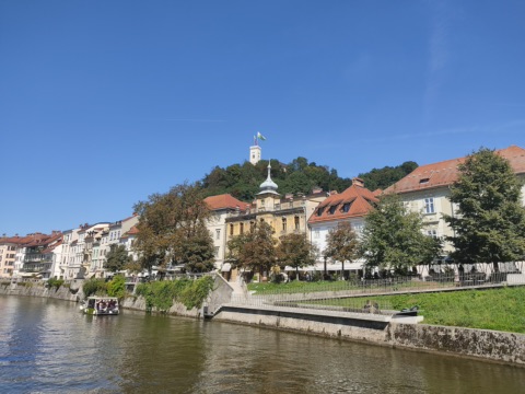
Ljubljana Castle towers over the old town on its wooded hill. From the valley station on Krekov trg, right next to the Central Market and the Puppet Theatre, the glass funicular takes you up in about a minute. At the top you’ll find the castle courtyard with cafés and restaurants, the lookout tower with views over the rooftops to the Julian Alps, the exhibition on Slovenian history, the puppet museum and a 4D film about the castle.
Allow two to three hours for your visit; it combines well with a stroll around the market and along the Ljubljanica. If you’d rather walk, several paths lead from the old town up to the castle courtyard in about 15 to 20 minutes. The exhibitions are a good choice in rainy weather too; children usually enjoy the puppet museum and the funicular ride most.
All year
At a glance
Funicular since 2006, approx. 70 m long, journey time around 60 seconds
Ljubljana101 km · 1 h 35 min by carSlovenia’s capital is one of the most relaxed cities in Europe and can be reached in under two hours – a perfect day trip when you feel like some city air.
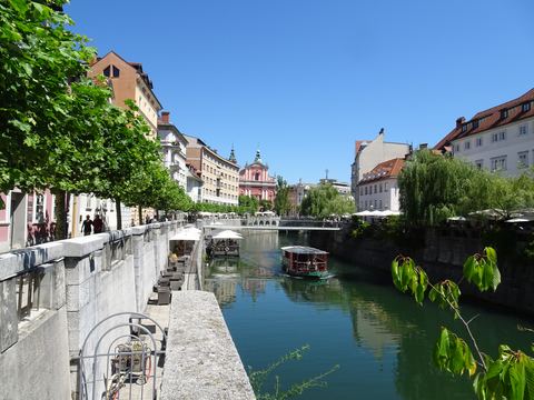
Slovenia’s capital is one of the most relaxed cities in Europe and can be reached in under two hours – a perfect day trip when you feel like some city air. The largely car-free old town nestles along the banks of the Ljubljanica; cafés and restaurants with terraces line the river. Around Prešeren Square and the famous Triple Bridge you can see the hand of the architect Jože Plečnik.
A dragon keeps watch here too, by the way – the city’s heraldic animal sits on the Dragon Bridge, a nice link to Klagenfurt’s Lindwurm. The funicular takes you up to the castle with a wide view all the way to the Alps. In the morning the Central Market with fruit, cheese and flowers is well worth a visit.
All year
At a glance
Car-free old town on the Ljubljanica
Triple Bridge and buildings by Jože Plečnik
Funicular up to the castle
Dragon Bridge – the dragon is the city’s heraldic animal
Mostnica Gorge (Korita Mostnice)105 km · 1 h 50 min by carJust above Stara Fužina on Lake Bohinj, the Mostnica has carved a gorge around two kilometres long into the limestone.
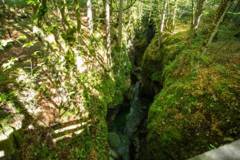
Just above Stara Fužina on Lake Bohinj, the Mostnica has carved a gorge around two kilometres long into the limestone. In places it is only about a metre wide. In the emerald-green water lie scoured-out pools and potholes, which you can see from stone bridges and from a path on both sides of the gorge. The circular path through the gorge starts at the old Devil’s Bridge (Hudičev most); it is easy and fine for children. Allow about one to one and a half hours.
If you want to go further, walk through the broad alpine valley of Voje to the 21-metre Mostnica waterfall (Slap Mostnice). It is around two and a half hours one way to the head of the valley, with two short climbs. There is an alpine hut on the way where you can stop for refreshments. Sturdy shoes are enough; bikes are not allowed through the gorge.
April–November
At a glance
Gorge approx. 2 km long, in places only 1 m wide
Mostnica waterfall at the end of the Voje valley, 21 m high
Admission 1 April – 30 November: adults €4, children aged 7–14 €2, under 6 free (as of 2026, bohinj.si)
Guided tours on Tuesdays in July and August
Our tip
Come early in the morning – you will still find a space in the Vorančkojca car park and have the narrow paths almost to yourself.
If you are in Bohinj, the visit goes nicely with a swim in Lake Bohinj.
Soča Valley (Bovec, Kobarid, Trenta)124 km · 1 h 40 min by carThe Soča is one of the most beautiful Alpine rivers in Europe: emerald green and crystal clear, it flows from its source in the Trenta valley through Triglav National Park to Bovec and Kobarid.
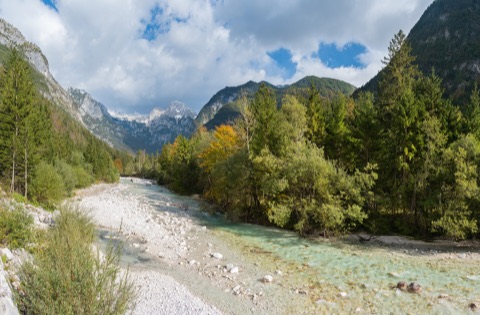
The Soča is one of the most beautiful Alpine rivers in Europe: emerald green and crystal clear, it flows from its source in the Trenta valley through Triglav National Park to Bovec and Kobarid. For a day trip, drive via Villach and the Wurzenpass or the Karawanks Tunnel to Kranjska Gora and then over the Vršič Pass (1,611 m) with its 50 hairpin bends into the valley. A somewhat quieter route is via Tarvisio and the Predil Pass.
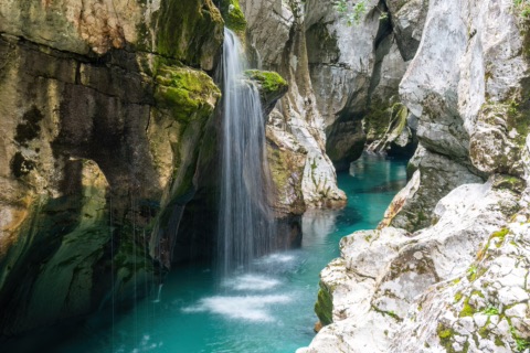
Worthwhile stops are the source of the Soča, the Great Soča Gorge (Velika korita) near the village of Soča, suspension bridges over the river, the Kozjak waterfall near Kobarid and the Kobarid Museum about the Isonzo Front in the First World War. In Bovec many operators offer rafting, kayaking and canyoning. Allow a whole day and bring hiking boots and a jacket. The water stays very cold even in high summer – you’ll hardly manage more than a quick paddle.
May–September (Vršič usually closed in winter)
At a glance
Vršič Pass 1,611 m, 50 hairpin bends; free pass bus 1 June–30 September 2026 (as of 2026)
Great Soča Gorge: approx. 750 m long, up to 15 m deep
Kozjak waterfall near Kobarid in a rock grotto
Rafting and kayaking season roughly April–October
Bring ID for Slovenia; for the motorway via the Karawanks Tunnel you need a Slovenian vignette
Our tip
Out over the Vršič, back over the Predil – that turns the drive into a round trip.
Check the traffic news on soca-valley.com before you set off: new traffic rules have applied on the Vršič since 2026, and in winter the pass is usually closed.
In July and August set off early – then it’s easier to find a parking space at the gorge and the waterfall.
Great Soča Gorge (Velika korita Soče)130 km · 1 h 45 min by carBetween Bovec and Trenta, the Soča has carved a channel about 750 metres long, up to 15 metres deep and often only a few metres wide into the pale limestone.
Between Bovec and Trenta, the Soča has carved a channel about 750 metres long, up to 15 metres deep and often only a few metres wide into the pale limestone. The water here glows emerald green, and in the pools below the little waterfalls it is almost turquoise. The finest view is from the suspension bridge at the upper end of the gorge; a waymarked forest path along the left bank, with several viewpoints, leads down to the exit at the turn-off into the Lepena valley.
The gorge lies in the Triglav National Park and combine well with a drive over the Vršič or Predil Pass. The bridge and the riverside path take just under an hour; if you like, you can walk on a little further along the Soča Trail. The water is ice-cold even in summer and the rocks are slippery when wet – please stay on the path and keep away from the edges.
May–October
At a glance
Gorge approx. 750 m long, up to 15 m deep
Suspension bridge at the upper end of the gorge
In the Triglav National Park, free admission
On the Bovec–Vršič road, approx. 11 km from Bovec
Our tip
Come in the morning – in high summer the car parks fill up quickly.
Wear sturdy shoes – the riverside path is stony and rooty in places.
Kozjak waterfall & Kobarid Museum145 km · 2 h by carIn the Soča valley, just above Kobarid, the Kozjak waterfall lies hidden in a half-cave: the Veliki Kozjak plunges around 15 metres between dark, smoothly polished rock walls into a green pool.
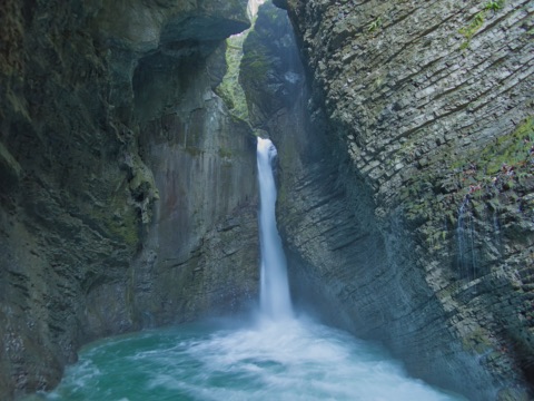
In the Soča valley, just above Kobarid, the Kozjak waterfall lies hidden in a half-cave: the Veliki Kozjak plunges around 15 metres between dark, smoothly polished rock walls into a green pool. From the car park near the Napoleon Bridge, a well-kept, wide path with suspension bridges leads to the viewing platform in about 30 minutes; on the way you also see the smaller Mali Kozjak. The path is easily manageable for families; sturdy footwear is enough. Visitors are asked not to swim, as the area is a nature reserve.
In the town centre, the Kobarid Museum (Kobariški muzej) tells the story of the Isonzo Front in the First World War and above all of the people who fought and suffered there – with photos, letters, finds and models of the front line. Allow about an hour and a half for the visit; the museum is open daily all year round and is also a good choice for rainy days. Together, the two make a full day out in the Soča valley.
Waterfall April–October (staffed), museum all year round
At a glance
Veliki Kozjak waterfall approx. 15 m, walking time from the car park approx. 30 min
Waterfall admission adults €5, children 7–14 €3, family €12 (as of 2026, 1 April–31 October)
Museum open daily, July/August 9:00–19:00, otherwise 9:00/10:00–17:00/18:00
Museum: Gregorčičeva ulica 10, 5222 Kobarid
Our tip
Parking by the waterfall is charged – according to travel reports you pay via the EasyPark app, so it is best to install the app beforehand.
If you’d like to walk more, link the two via the Kobarid Historical Trail (Kobariška zgodovinska pot), around 7 km long.
Tolmin Gorges (Tolminska korita)163 km · 2 h 20 min by carAbove Tolmin, the Tolminka and the Zadlaščica flow together in narrow, turquoise-green gorges.
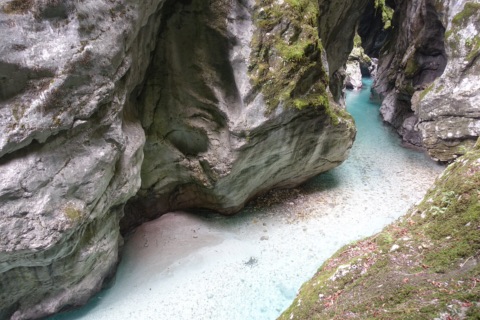
Above Tolmin, the Tolminka and the Zadlaščica flow together in narrow, turquoise-green gorges. The confluence lies at around 180 metres above sea level and is the lowest point of the Triglav National Park. A one-way path of about two kilometres leads from the ticket office over bridges and walkways through the gorge. Along the way you pass a lukewarm spring, Dante’s Cave and the Bear’s Head, a boulder wedged in the gorge. At the end you climb up to the Devil’s Bridge, 60 metres above the Tolminka.
Allow about an hour and a half for the circuit. The path has around 500 steps, is steep in places and slippery when wet, so you need sturdy shoes with a good tread. Pushchairs are unsuitable; a baby carrier works well. Dogs are allowed on a lead. The drive takes more than two hours, so the gorge makes a good destination for a day trip to the Soča valley, perhaps together with Kobarid.
Approx. late March to early November
At a glance
Circular path approx. 2 km, about 1.5 h, approx. 500 steps
Admission June–Sep adults €12, children 6–15 €6 (as of 2026)
New entrance building since March 2026, timed tickets online
Free car parks P2/P3 with summer shuttle bus
Our tip
In summer, buy your ticket online in advance, as places per time slot are limited.
Park for free at P2 or P3 and take the free shuttle; car park P1 right at the entrance charges a fee.
Micotra train with your bike (Villach – Udine – Trieste)68 km · 58 min by carThe Micotra is a cross-border regional train from Villach via Tarvisio, Pontebba, Venzone and Gemona to Udine.
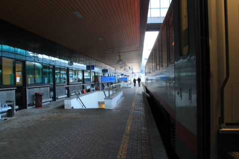
The Micotra is a cross-border regional train from Villach via Tarvisio, Pontebba, Venzone and Gemona to Udine. At weekends and on public holidays it continues to Trieste. The train is designed for cyclists and has room for a great many bikes. This makes it easy to ride the Alpe-Adria Cycle Path in one direction: you cycle from Villach through the Kanaltal and downhill along the former railway line to Venzone or Udine and take the train back. Or you take the train there and cycle back.
There are two pairs of trains a day between Villach and Udine, so space is limited. You need a reservation for your bike. It is free and is booked automatically when you buy the bike ticket via the ÖBB ticket shop or app. Allow a day for cycling from Villach to Venzone. Bring ID, and for breaks in Italy a lock and cash come in handy.
All year; with a bike mainly April–October
At a glance
Route Villach Hbf – Tarvisio – Venzone – Gemona – Udine, Sat/Sun/public holidays on to Trieste Centrale
2 pairs of trains daily (D 1821/1823), operated by FUC with ÖBB
Bike reservation compulsory, free with the bike ticket (as of 2026)
The Aktiv-Ticket Kärnten is valid on the Micotra on the Austrian section (as of 2026)
Our tip
In summer, book your bike ticket and reservation a few days in advance; the trains are often full.
Check the ÖBB app before you travel for any rail replacement service – buses run during engineering works.
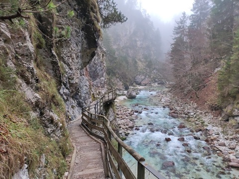
Orrido dello Slizza (Slizza Gorge) near Tarvisio94 km · 1 h 5 min by carOn the edge of Tarvisio the Slizza (Schlitza in German) has cut deep into the limestone.
On the edge of Tarvisio the Slizza (Schlitza in German) has cut deep into the limestone. A path leads through the narrow gorge: over wooden walkways hanging on the rock face above the emerald-green water, through a hand-hewn tunnel and a large grotto, right down to the water’s edge. From below you see the 63-metre-high railway bridge of the former Tarvisio–Ljubljana line, which now carries the Alpe-Adria Cycle Path.
The loop is about 1.5 kilometres long with around 90 metres of ascent and takes an easy hour. It starts from a small car park on Via Bamberga by the Alpe-Adria Cycle Path, near the memorial to the Austrian riflemen of 1809. The descent is steep and zigzags down; after rain the walkways and stones are slippery. For children the path is a little adventure, but they should be good walkers.
May–October
At a glance
Loop approx. 1.5 km, approx. 90 m of ascent, approx. 1 hour
Hanging walkways, rock tunnel and grotto
Start: Via Bamberga, Tarvisio (Italy), on the Alpe-Adria Cycle Path
Free access
Our tip
Wear hiking or mountain boots with a good tread – the descent is steep.
Combines well with a stage on the Alpe-Adria Cycle Path or a visit to the Tarvisio market.
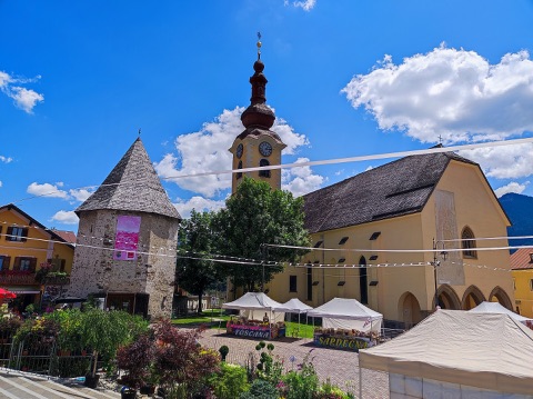
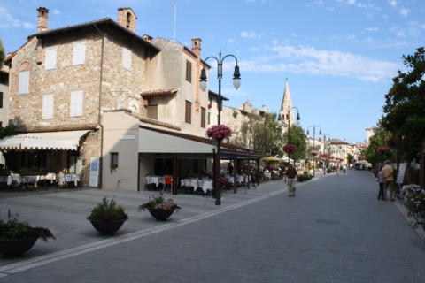
Tarvisio – border town in the Kanaltal96 km · 1 h 10 min by carTarvisio lies just across the border from Arnoldstein in the Kanaltal (Val Canale), where Italy, Austria and Slovenia meet.
Tarvisio lies just across the border from Arnoldstein in the Kanaltal (Val Canale), where Italy, Austria and Slovenia meet. Many Carinthians used to come for the big Tarvisio market. It has lost much of its importance: weekdays are quiet now, weekends are busier. Today you are more likely to come for an espresso on the Piazza Unità, for Italian groceries and for a stroll along the Via Roma. Worth seeing is the late Gothic parish church of St. Peter and Paul from 1445, with frescoes.
Tarvisio makes a good base for a day trip. Close by are the Weißenfelser Seen (Laghi di Fusine) below the Mangart. From Saifnitz (Camporosso) a gondola runs up the Luschariberg (Monte Lussari) with its pilgrimage church. One to two hours are enough for the town itself. Bring your ID.
All year
At a glance
Italian border town in the Kanaltal, approx. 750 m above sea level
Parish church of St. Peter and Paul, late Gothic, 1445
Starting point for the Weißenfelser Seen and Monte Lussari
Tarvisio-Boscoverde station on the Villach–Udine line
Our tip
Combine Tarvisio with a walk at the Weißenfelser Seen.
Many shops close over lunch, so plan your shopping for the morning or late afternoon.
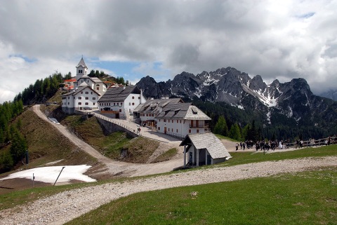
Pilgrims’ trail up Monte Lussari (Luschariberg)100 km · 1 h 15 min by carMonte Santo di Lussari – Luschariberg in German, Svete Višarje in Slovenian – has been a place of pilgrimage since the Middle Ages, where Italian, Slovenian and German-speaking pilgrims meet.
Monte Santo di Lussari – Luschariberg in German, Svete Višarje in Slovenian – has been a place of pilgrimage since the Middle Ages, where Italian, Slovenian and German-speaking pilgrims meet. On the summit ridge at around 1,790 m stand the pilgrimage church and a small village with inns, and all around the view opens up to the Julian Alps with Wischberg and Jôf di Montasio. The old pilgrims’ trail (Sentiero del Pellegrino, CAI 613) starts in Camporosso/Saifnitz near Tarvisio and climbs through mountain forest all the way.
Reckon on around 1,000 metres of ascent and 2.5 to 3 hours of walking. The path is technically easy but long and steadily steep – sure-footedness, sturdy shoes, enough water and a jacket for the top are a must. You get back down to the valley comfortably by gondola, which arrives a few minutes from the starting point in Camporosso. If you are short of time, take the gondola up and only walk down.
June to early October (free of snow; check gondola operation in advance)
At a glance
Pilgrimage church and village at approx. 1,790 m
Trail CAI 613 from Camporosso (approx. 810 m), around 1,000 m of ascent
Walking time up approx. 2.5–3 h
Return by the Monte Lussari gondola to Camporosso
Our tip
Check the gondola’s current operating times before you set off, so you don’t miss the last ride down.
Park at the valley station in Camporosso – that is where the pilgrims’ trail starts and where the gondola comes back down.
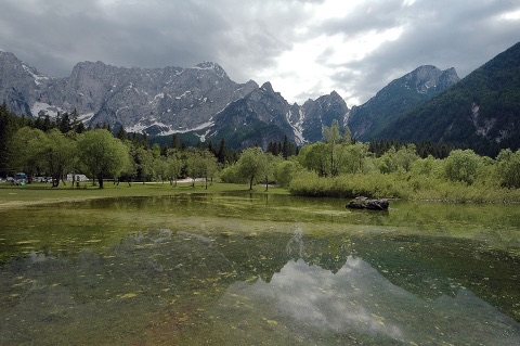
Weißenfelser Seen (Laghi di Fusine)103 km · 1 h 20 min by carJust across the border near Tarvisio, two small mountain lakes lie in the Fusine Nature Park, the lower lake at around 924 metres and the upper one a few metres higher.
Just across the border near Tarvisio, two small mountain lakes lie in the Fusine Nature Park, the lower lake at around 924 metres and the upper one a few metres higher. Above them rises the north face of the Mangart, which on calm days is mirrored in the green-blue water. Level footpaths lead around both lakes through spruce and beech forest. A circuit of one lake takes about half an hour; for both together, with breaks, allow a good two hours. The path is well suited to children and dogs too.
If you would like to walk further, climb from the upper lake on a wide gravel road or on steeper paths up to the Rifugio Zacchi (1,380 m) below the Ponze peaks. The hut is open in summer. There and back takes around two to three hours. Swimming in the lakes is not usual, as the water is very cold. Bring sturdy shoes and a packed lunch, although there are also inns by the lakes.
May–October
At a glance
Lower lake approx. 924 m, upper lake a few metres higher
Level lake circuits, both lakes together approx. 2 h with breaks
Climb to the Rifugio Zacchi (1,380 m) possible
Car parks at both lakes, charged in summer
Location: Fusine in Valromana, municipality of Tarvisio (Italy)
Our tip
On summer weekends come early in the morning, as the car parks by the lakes fill up quickly.
Combines well with a drive over the Wurzenpass or to Kranjska Gora.
Gemona del Friuli – cathedral and old town170 km · 2 h by carGemona del Friuli sits where the Tagliamento valley opens out into the Friulian plain, about 30 kilometres north of Udine.
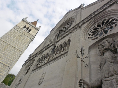
Gemona del Friuli sits where the Tagliamento valley opens out into the Friulian plain, about 30 kilometres north of Udine. In May 1976 the town was at the centre of the severe Friuli earthquake, in which 965 people died; the old town on the hillside was afterwards carefully rebuilt. Along the main street, Via Bini, you stroll up to the cathedral of Santa Maria Assunta. On its façade, the large rose window and the stone figure of St Christopher from 1331, about seven metres tall, catch the eye. Inside, some columns still lean slightly to this day – a trace of the earthquakes deliberately left visible.
Allow one to two hours for the old town and cathedral; comfortable shoes help on the steep lanes. Gemona combines well with nearby Venzone, which was also rebuilt stone by stone after the earthquake; together they make a relaxed day trip via the A23 motorway.
All year
At a glance
Cathedral built 1290–1337, campanile 1341–1369 (rebuilt after 1976)
St Christopher statue on the façade, approx. 7 m tall (1331/32)
Earthquake on 6 May 1976, magnitude 6.5, 965 dead
Altitude 272 m, about 10,400 inhabitants
Our tip
Park below the centre and walk the last few metres to the cathedral.
Combine your visit with Venzone, just a few kilometres further north.
Udine – Piazza della Libertà191 km · 2 h 15 min by carThe Piazza della Libertà is Udine’s oldest square and is considered the most beautiful Venetian-style square on the mainland.
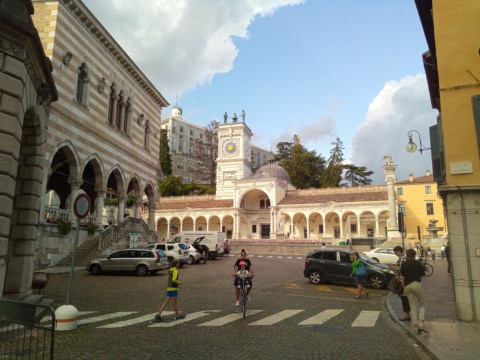
The Piazza della Libertà is Udine’s oldest square and is considered the most beautiful Venetian-style square on the mainland. Here stands the Gothic Loggia del Lionello with its alternating white and pink stone, and opposite it the portico of San Giovanni with the clock tower, whose two Moor figures strike the hours. On the raised centre of the square you’ll find a Renaissance fountain, the column with the Lion of St Mark, the column of Justice and the statues of Hercules and Cacus.
Through the Bollani Arch, designed by Andrea Palladio, it’s just a few minutes’ walk up to the castle hill with the city museums and a view over the Friulian plain. For a day trip, combine it with the Tiepolo frescoes in the Palazzo Patriarcale and a stroll through the lanes around Via Mercatovecchio. A typical stop is an osteria for a “tajut”, a glass of Friulian wine, with a few nibbles. Allow about half a day for the square, castle hill and old town.
All year
At a glance
Loggia del Lionello: Gothic building, planned from 1448
Clock tower from 1527 (Giovanni da Udine)
Arco Bollani from 1556, designed by Andrea Palladio
Square and old town freely accessible all year round
Our tip
Park in one of the underground car parks on the edge of the old town; the centre is largely traffic-calmed.
The osterie around the square are liveliest in the late afternoon.
Grotta Gigante (Giant Cave) near Trieste185 km · 2 h 25 min by carIn the Karst above Trieste, near Sgonico, lies the Grotta Gigante, one of the largest show caves in the world.
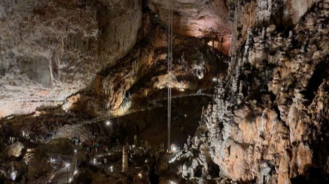
In the Karst above Trieste, near Sgonico, lies the Grotta Gigante, one of the largest show caves in the world. Its main hall is almost 100 metres high, around 76 metres wide and 167 metres long – a church tower would fit inside with room to spare. In the middle of the hall hang two pendulums, 94 metres long, which geologists use to measure the tides of the Earth’s crust.
The cave can only be visited on a guided tour, which takes about an hour. The route is around 850 metres long and takes you down about 500 steps and back up as many again; it is not suitable for pushchairs or wheelchairs. Inside the cave it is 11 °C all year round, so bring a jumper and non-slip shoes even in summer. The cave makes a good rainy-day outing or can be combined with a day in Trieste.
All year (March–August daily, otherwise Tue–Sun)
At a glance
Main hall 98.5 m high, 76 m wide, 167 m long
Guided tour approx. 1 h, around 500 steps down and back up
A constant 11 °C
March–August daily, September–February Tue–Sun; tours hourly from about 9:00 to 16:00
Our tip
Check the tour times beforehand on grottagigante.it – in autumn and winter it is closed on Mondays.
The small cave museum in front of the entrance is included in the ticket and a good introduction for children.
Trieste – Piazza Unità and coffee houses188 km · 2 h 35 min by carFor centuries Trieste was the port of the Habsburg Monarchy, and the city still shows it today.
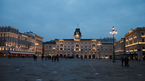
For centuries Trieste was the port of the Habsburg Monarchy, and the city still shows it today. At its heart is the Piazza Unità d’Italia, a wide square open to the sea between the town hall, the government palace and splendid townhouses. From here you can stroll out onto the Molo Audace, which juts far out into the sea, and along the Canal Grande into the Borgo Teresiano. Behind the square lie the Roman theatre, the old town and the San Giusto hill with its cathedral and castle.
Coffee-house culture is part of Trieste: at the Caffè degli Specchi right on the Piazza or at the Antico Caffè San Marco from 1914, once frequented by writers, you order your coffee the Trieste way, for example a “Capo in B”. For a day trip, plan the whole day – the drive takes a good two and a half hours each way. If it rains, the cafés and museums are good alternatives.
All year
At a glance
Piazza Unità d’Italia: Europe’s largest square open to the sea
Antico Caffè San Marco, Via Cesare Battisti 18, founded 1914
Roman theatre from the 1st century AD in the middle of the city
Drive approx. 2½ h via Villach and Udine
Our tip
Park in one of the multi-storey car parks by the harbour and explore the city centre on foot.
A detour to Miramare Castle on the coast combines well with a visit to the city.
In a coffee house, order a “Nero” (espresso) or “Capo” (macchiato) – the names in Trieste differ from the rest of Italy.
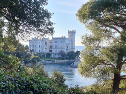
Miramare Castle (Trieste)191 km · 2 h 40 min by carOn a rocky promontory in the Gulf of Trieste, Archduke Ferdinand Maximilian – the younger brother of Emperor Franz Joseph and later Emperor of Mexico – had his white castle built right above the sea from 1856 onwards.
On a rocky promontory in the Gulf of Trieste, Archduke Ferdinand Maximilian – the younger brother of Emperor Franz Joseph and later Emperor of Mexico – had his white castle built right above the sea from 1856 onwards. Today it is a state museum. You walk through the originally furnished living rooms, library and throne room and see many mementoes of Maximilian and his wife Charlotte. Allow about an hour for the castle; the same goes for the audio guide.
The park of around 22 hectares is freely accessible. With exotic trees, ponds and viewpoints it stretches up the hillside, and down at the little harbour you can look across the Adriatic as far as Trieste. The trip combines well with a stroll through Trieste or a swimming stop in Grignano. There are only a few parking spaces at the castle, so many visitors come on bus no. 6 from Trieste or, in summer, by boat.
All year
At a glance
Castle daily 9:00–19:00 (ticket office until 18:30), park from 8:00, in summer until 19:00
Admission to the castle €17 incl. special exhibition (as of 2026), park free
Audio guide approx. 60 minutes (€4, as of 2026)
Built 1856–1860 for Archduke Maximilian
Our tip
Bring comfortable shoes for the park, as the paths go quite steeply uphill.
On summer weekends, come early, as the few parking spaces fill up quickly.
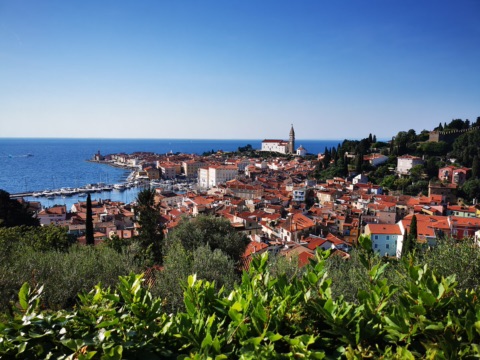
Piran sits on a narrow spit of land on the Adriatic and still has a strongly Venetian character. At its heart is the oval Tartini Square with the monument to the violinist Giuseppe Tartini; from there narrow lanes lead up to St. George’s Church with its free-standing bell tower and on to the old town wall, from which you look across the rooftops to the sea. On the waterfront promenade you can swim, eat fish or simply watch the boats.
Piran is a long day trip – plan the whole day and set off early. The old town is car-free for visitors: you park in the Fornače garage outside town and walk about 15 minutes along the coast or take the shuttle bus to Tartini Square. Nearby are the seaside resort of Portorož and the Sečovlje salt pans, where sea salt is still harvested by hand today.
May–September
At a glance
Old town car-free for visitors, Fornače car park with around 845 spaces
Shuttle bus Fornače – Tartini Square, about every 15 minutes
Worth seeing: Tartini Square, St. George’s Church, town wall
Sečovlje salt pans and Portorož nearby
Our tip
To drive through Slovenia you need a digital motorway vignette (e-Vinjeta) – buy it online in advance.
Bring your swimming things: there are places along the promenade to get into the sea.
Grado – old town, beach and lagoon238 km · 2 h 55 min by carGrado lies on an island between the Adriatic and the lagoon and was already the Austrians’ seaside resort in the days of the monarchy.
Grado lies on an island between the Adriatic and the lagoon and was already the Austrians’ seaside resort in the days of the monarchy. The fine sandy beach shelves very gently and is well suited to families with small children; besides the large main beach with facilities, there are also free public stretches of beach. Along the seafront promenade you can stroll to the old town.
In the narrow lanes of the Castrum stands the 6th-century Basilica of Sant’Eufemia with its mosaic floor and bell tower, and right next to it the baptistery and Santa Maria delle Grazie. Around the old harbour you’ll find fish restaurants and ice-cream parlours. Boats leave the harbour for the lagoon, for example to the pilgrimage island of Barbana. Grado is also the end point of the Alpe-Adria Cycle Path. For a day trip, set off early; pack swimwear and sun protection.
Swimming May–September, old town all year
At a glance
Gently shelving sandy beach, swimming season May–September
Basilica of Sant’Eufemia, 6th century, with mosaic floor
Boat trips into the lagoon, e.g. to Barbana
End point of the Alpe-Adria Cycle Path (Salzburg–Grado)
Our tip
On summer weekends traffic tends to back up on the road into Grado – during the week it is more relaxed.
In the evening, when the restaurants on the little squares open, a stroll through the old town is well worth it.
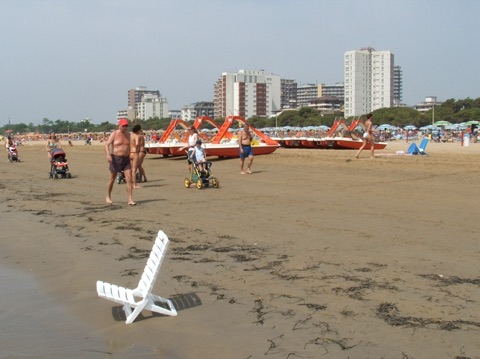
Lignano Sabbiadoro – beach254 km · 3 h by carLignano Sabbiadoro lies on a peninsula between the Marano lagoon and the mouth of the Tagliamento and is the nearest large sandy beach on the Adriatic.
Lignano Sabbiadoro lies on a peninsula between the Marano lagoon and the mouth of the Tagliamento and is the nearest large sandy beach on the Adriatic. The fine sandy beach stretches for around eight kilometres through the three districts of Sabbiadoro, Pineta and Riviera and slopes gently into the sea – ideal for families with younger children. Sun loungers and parasols can be hired on the numbered beach sections, with free areas in between.
The landmark is the Terrazza a Mare, a shell-shaped building on stilts in the sea dating from 1972, which is currently being redesigned. In Pineta, a stroll through the spiral-shaped town centre in the pine forest is worthwhile, and in Riviera you’ll find the Aquasplash water park. For a day trip, set off early, as the route via Udine and the A4 is very busy on summer weekends.
May–September
At a glance
Sandy beach approx. 8 km, gently sloping
Districts of Sabbiadoro, Pineta and Riviera
Awarded the Blue Flag for many years
Aquasplash water park, boat connections to Grado and Marano
Our tip
Go on a weekday – on Saturdays the A4 towards Lignano is often congested.
If you prefer it quieter, Pineta and Riviera are less hectic than Sabbiadoro.
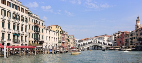
From southern Carinthia, Venice is a long but very doable day trip. You explore the lagoon city on foot and by vaporetto, the water buses: across St Mark’s Square with the basilica and the Doge’s Palace, to the Rialto Bridge on the Grand Canal and through the lanes of Cannaregio or Castello, where things are much quieter than in the centre. A ride along the whole Grand Canal on vaporetto line 1 is the easiest sightseeing tour.
By car you park at Piazzale Roma, on the island of Tronchetto or, more cheaply, in Mestre and take the bus or train into the old town. The train is also comfortable: Railjets run from Klagenfurt and Villach via Udine to Santa Lucia station right on the Grand Canal. Allow a full day, wear comfortable shoes and, if you can, avoid weekends in high summer. On selected days, day visitors have to pay an access fee online in advance.
All year
At a glance
Old town and lagoon a UNESCO World Heritage Site since 1987
Access fee for day visitors 2026: €5 if booked early, otherwise €10, on 60 days April–July, 8:30–16:00; children under 14 free (as of 2026)
Train: Railjet from Klagenfurt/Villach to Venezia Santa Lucia
Parking: Piazzale Roma, Tronchetto or Mestre
Our tip
Before you go, check on cda.ve.it whether the access fee applies on the day you want to visit.
If you plan more than two vaporetto rides, a day ticket is worth it.